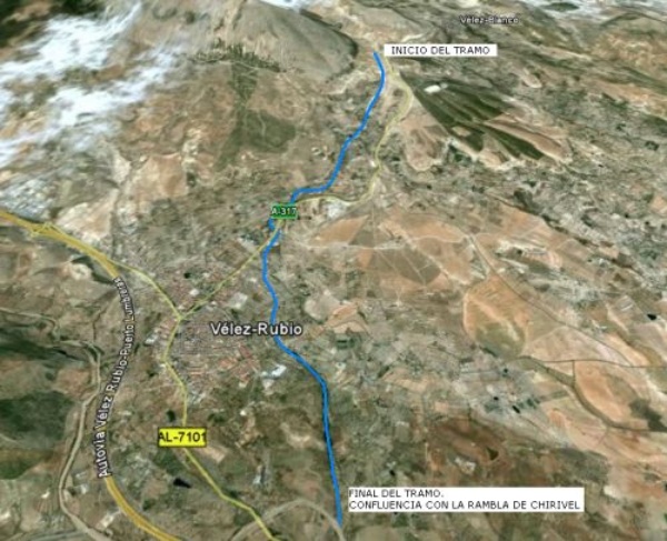
The Chico river, a tributary of the Chirivel riverbed on the left margin, has its source in the southeastern slopes of the María range and flows through the municipalities of Vélez Blanco y Vélez Rubio. The section subject to restoration begins downstream from the Sierra Maria– Natural Park boundaries, Los Vélez, at the foot of the Maimón, up to where it meets the Chirivel riverbed, for an approximate length of 6 km.

Location map
The Chico river restoration project aims at improving its ecological condition, currently degraded by morphological alterations, including closure dams, breakwater cladding and canalization of the stretch close to Vélez Rubio, which cause a significant disconnection of the watercourse with its banks, loss of river area and decline of the ecosystem on its banks, so as to achieve the objectives of the National River Restoration Startegy.
| Phase | Status |
|---|---|
| Ecological Condition Assessment(ECA) |
Checked out |
| Open Day. It was held on 04/01/2009 at 10:00 a.m. in the Auditorium of the Fernando Palanques Public Library in Vélez Rubio |
Held |
| Project drafting | Pending |
| Meeting to present the Project actions. It was held on 05/26/2010 at 9:00 a.m. in the Auditorium of the Fernando Palanques Public Library in Vélez Rubio and on 05/26/2010 at 12:00 a.m. in the Vélez Blanco town hall chamber. |
Held |

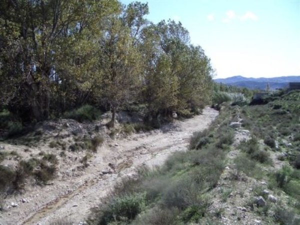
Río Chico photograph


