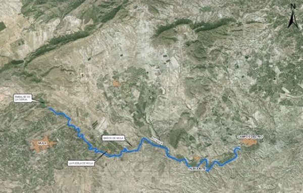
The Mula river, a tributary of the Segura on its right margin and with a length of approximately 64 km, has its source at the Fuentes de Mula, 670 meters above sea level, and recieves significant water inputs from the Buret, Lavia, Ceperos, Plaza de los Pastores and El Charco sloping riverbeds. The section subject to ecological improvement goes downstream from the Cierva dam up to the border between the municipalities of Albudeite and Campos del Río, for an approximate length of 18 km.

Location map
In order to achieve the goals of the National River Restoration Strategy, the project aims at improving the ecological condition of this section of the river, currently degraded by the alteration of its natural flow and other human-induced stresses (invasion of non-native species, stress due to agricultural activities, etc.) which are causing the decline of the riverbank ecosystem.
| Phase | Status |
|---|---|
| Ecological Condition Assessment (ECA) |
Checked out |
| Open Day. Two meetings were held: On 07/15/2009 at 10:30 a.m. in the Mula townhall. Plaza del Hospital s/n next to the Public Libray. On 07/15/2009 at 17:00 pm in the Albudeite Townhall Auditorium |
Held |
| Project drafting | Pending |
| Meeting for the presentation of the Project Actions: 06/17/2010 at 10:00 a.m. at the Cultural Events Hall of Caja Murcia in Mula (c/Boticas) and 06/17/2010 at the Auditorium of the Hon. Albudeite Town hall. |
Pending |

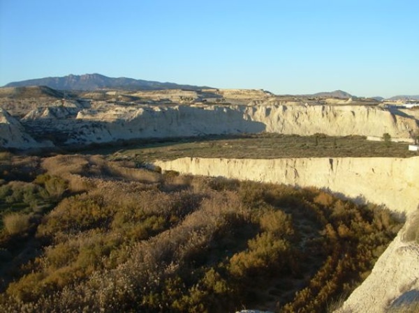
Río Mula photograph


